


San Antonio was at the center of the Mexican American civil rights movement.
Groups like the Mexican American Legal Defense and Educational Fund and the Southwest Voter Registration Project got their start in San Antonio.
Fifteen sites on San Antonio’s historic West Side are featured in a new interactive, self-guided walking and driving tour called Mapping the Movimiento.

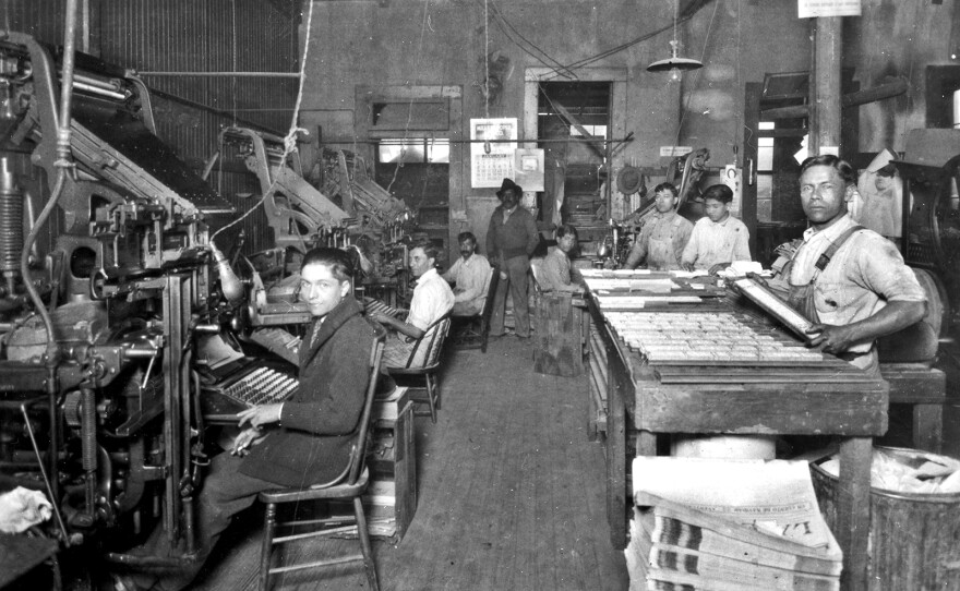
It takes you to St. Mary’s University, Edgewood High School, and the Alazán-Apache courts, and places no longer standing, like Munguía Printers and Mario’s Restaurant.
The University of Texas at San Antonio Libraries has collaborated with the Institute of Texan Cultures to create an interactive map of the places where activism and advocacy were born.
“We know that there are more than 15 sites that represent the movimiento here in San Antonio,” said Dean Hendrix, Vice Provost and University Librarian at UTSA. “But we're starting out with this pilot of 15 sites.”
“We are living in a moment where many of our leaders from this period are aging,” said John Phillip Santos, professor of Mestizo Cultural Studies at UTSA and narrator of the tour. “They’re elders now, and some have already passed…We're offering this project as a way to make it possible for schools to use these resources to give our students a sense of their own history.”
Take the interactive tour here.

