-
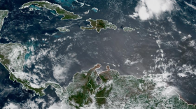
 With a Super El Niño brewing in the atmosphere, there's concern about what the weather pattern means for the U.S. and the Southwest. Texas is already experiencing another summer of weather extremes: destructive rainfall and flooding followed by dangerous heat, with Tropical Storm Bertha now moving across the northern Gulf of Mexico.
 -
 The week ahead includes Saharan dust, city office closures, and fireworks fun.
 -
 The new movie, based on writer and actor David Haig's 2014 play, dramatizes the tensions between military leaders and meteorologists in the lead up to the Allied invasion of Normandy.
 -
 Spring storms in Texas can bring heavy rain, flash flooding, tornadoes — and hail. Sometimes the hail is pea-sized and harmless. Other times, it’s big enough to smash windshields, shred roofs and leave homeowners with costly repairs. But there is still a lot about hail that we don’t fully understand.
 -
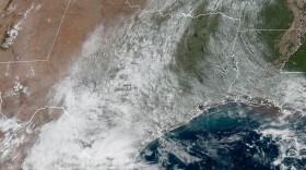
 The rain could begin falling on isolated areas of San Antonio on Tuesday afternoon and become more widespread by Wednesday. Most of the city should see rain on Thursday.
 -
 A cold front is expected mid-week in the San Antonio area.
 -
 Some beneficial rains fell over the Edwards Aquifer Recharge Zone to temporarily reverse its decline.
 -
 Active spring weather patterns continue to stir up the atmosphere.
 -
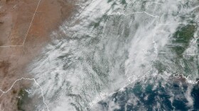
 An unsettled weather pattern in the central U.S. could be a significant rainmaker.
 -
 A cold front will push through San Antonio on Saturday.

© 2026 Texas Public Radio
Real. Reliable. Texas Public Radio.
Play Live Radio
Next Up:
0:00
0:00
Available On Air Stations


