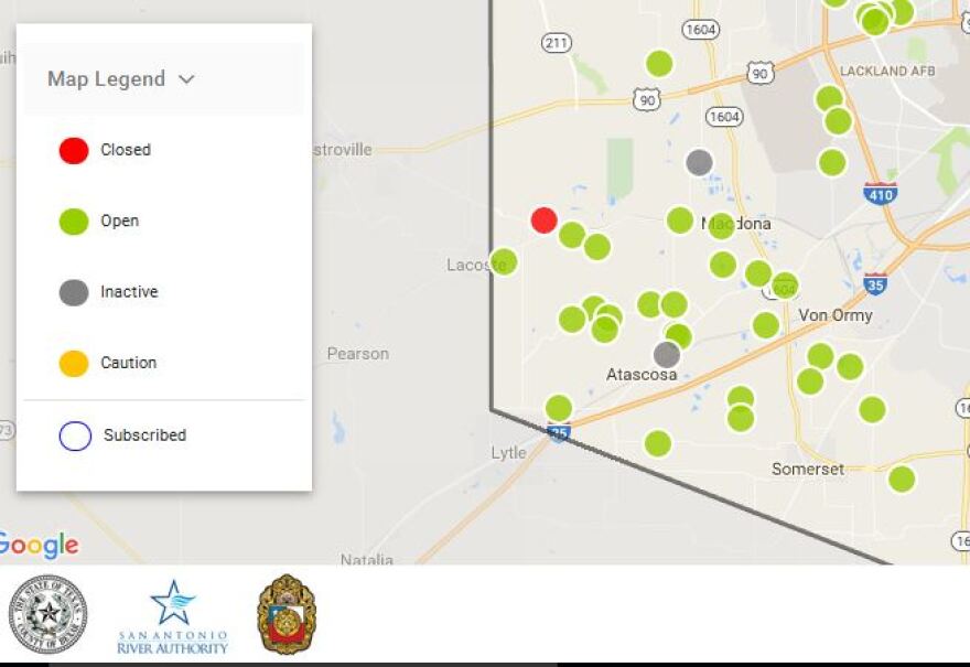
Bexar County has a new website designed to help save lives by letting people know when low water crossings become flooded.
Public Works Director Renee Green addressed Commissioners Court on Tuesday about the High water Alert Lifesaving Technology, or HALT website.
“Each one of these green dots obviously represents one of those sites and the individual citizens can go in and subscribe to the site. They can click on the dot that interests them and they can get email and text notifications when that site becomes active," Green says.
The subscriber will also be notified through email or text when the low water crossing is open again. There are 185 sites on the website at BexarFlood.org. Green says a mobile app is coming soon.
The new site is the result of a partnership between Bexar County, the City of San Antonio and the San Antonio River Authority. It gathers data from a total of 185 monitored low water crossings.
Bexar County began the HALT program in 2008. It's cost more than $10.3 million that was funded through the Bexar County Flood Control Program, a $10-year, $500 million capital improvement program.
“Flash flooding presents a unique threat in this community and is the leading cause of weather-related deaths in the Unites States,” said Bexar County Judge Nelson Wolff in a press release. “By installing these HALT sites we are warning drivers with lights and barricades that a road is not safe the very minute water reaches a certain depth.”


