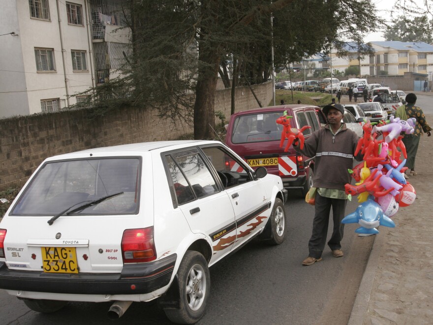
Traffic in Nairobi is so mind-numbing it makes Los Angeles' Interstate 5 look like the Autobahn. Motorcycles squeeze between cars and trucks that practically park on major boulevards and highways. Street peddlers walk to and fro selling newspapers, flowers, air fresheners and children's toys to captive audiences. Roundabouts become cartoonishly clogged.
Nairobi is the world's fourth-most congested city, far worse than any in the U.S., according to a 2011 survey. Kenya's government estimates traffic jams cost Nairobi $600,000 per day in lost productivity and wasted fuel. That's $219 million per year.
The source of the gridlock: Infrastructure made obsolete by a growing population that's keen on cars. "Much of Nairobi's road network is more than half a century old and was developed for a city of just 350,000 inhabitants," says Osamuyimen "Uyi" Stewart, an IBM scientist.
Since then, Nairobi's population has swelled to 2.3 million, and like many African cities, it can't build roads as fast as its residents can buy cars. Four-hundred new vehicles hit the streets here each day.
It all portends more congestion, frustration and waste, unless Nairobi can find a different type of solution for its traffic woes. One team at IBM's headquarters in Nairobi thinks it has found an answer — and if it works, it could provide relief to millions of commuters throughout the developing world.
Let's Go
Twende Twende, which means "let's go" in Swahili, allows cellphone users to text the name of a street or intersection and receive an instant traffic report. Drivers use that information to avoid major congested routes in favor of quicker ones, or to consider taking back streets, many of which are underused, IBM's data suggest. The service launched in November 2013.

The data come from a local Internet service provider that maintains across the city. The images are low quality, but they're enough for IBM software to use for tracking cars, estimating the speed of traffic flow and predicting traffic conditions on nearby roads.
To be sure, the program is clunky, with most roads and intersections thus far unaccounted for. Project engineer Eric Mibuari says it still needs "groundtruthing": a group of people to fan out across the city to verify whether traffic is indeed as good or as bad as the system predicts. IBM doesn't have statistics on how many drivers use Twende Twende, and few people here seem to have heard of the system so far — but that could well change.
The system has already caught the attention of Kenya's government: This month the Nairobi police launched a traffic control center that, like Twende Twende, uses CCTV cameras to help traffic cops better direct traffic flow. Alas, the public website that is supposed to broadcast data from the images doesn't seem to be functional yet.
For Twende Twende to take off, IBM hopes a government agency or company will expand upon it, or even monetize it, by giving it a nicer interface for smartphone users, for instance, to better resemble existing mobile mapping services in the U.S. and elsewhere, Mibuari says.
The Hub For Frugal Traffic Technology
Most Western cities already have something better than Twende Twende: Think Waze, a navigation app that constantly collects data as you drive and prompts you to enter additional information such as police traps or accidents.
But services like Waze depend on the widespread use of smartphones, which only 15 percent of Kenyans have. "So we try to get as much as we can out of SMS," Mibuari says. "The theme is frugal innovation. We want to do a lot with a little."
It's an idea that appeals to many across the developing world.
"The same sort of traffic problems we see in Nairobi are happening across the continent where there is rapid urbanization," Mibuari says. "Whether it's Accra, Lagos or Kampala, these issues are replicated. So if this solution succeeds in Nairobi, that's something we could replicate across the continent."
Eleven of the world's 15 largest cities are in developing countries. People living in Africa's megacities are as concerned as anyone with the toll traffic jams take on their daily lives: 60 percent of Nairobi residents surveyed by IBM said traffic "was affecting their productivity, forcing them to sacrifice time with their families and work in order to get to destinations on time."
Across the African continent, private developers are attempting to solve traffic woes in similar, often low-tech ways. In Nigeria, for instance, an attractive app helps smartphone users navigate Africa's largest city, Lagos. In Ghana, drivers use platforms based on Twitter and other social media to monitor traffic, similar to how Kenyan drivers use the Twitter hashtag #overlapKE to share information on the road.
So far, though, Nairobi seems to be the primary hub for traffic innovations in Africa. Besides Twende Twende and the government's SMS traffic control center, there's , a site that relies on crowdsourcing, much like Waze, to allow drivers to help one another avoid jams — but it's constrained by the low number of smartphone users in Nairobi. And in January, MIT released its Digital Matatus map of public transit here along with the data it used so developers can integrate that information into their own mapping and traffic apps.
"Nairobi is a modern capitalist city with people that care about getting from A to B as fast as possible so they can hustle, so they can be at work on time," Mibuari says. "Things move really fast."
Copyright 2020 Ozy.com. To see more, visit . 9(MDAwMTM1NDgzMDEyMzg2MDcwMzJjODJiYQ004))

