A tropical disturbance hovering off the lower coast of Texas is expected to move north over southeastern portions of the state sometime later this weekend.
Forecasters said even if it grows into a tropical depression, rain chances for San Antonio remain slim. The rain will fall east of I-35 and in most cases, far east.
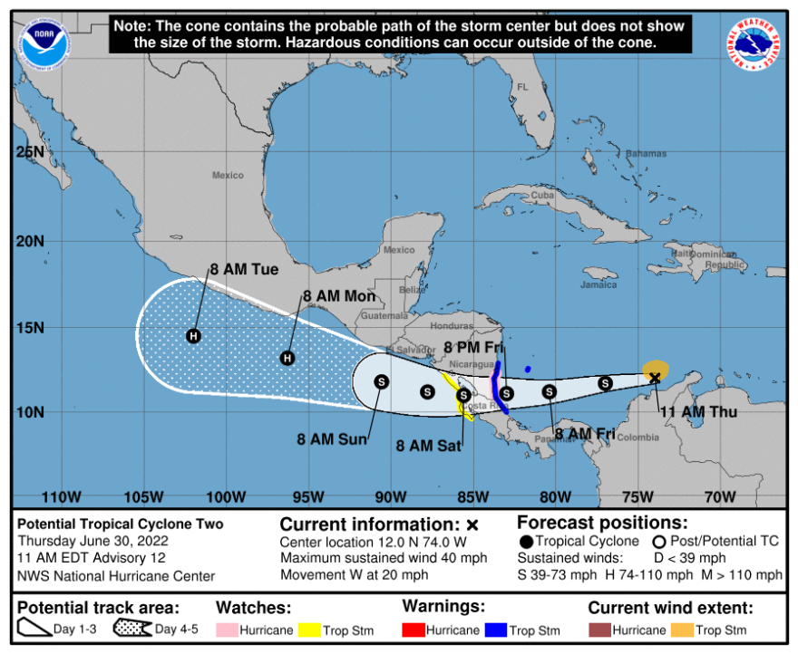
Meanwhile, what was being called potential Tropical Storm 2 by the National Hurricane Center late Thursday morning was located just north of the tip of Columbia. It was expected to move west over Nicaragua and Costa Rico this weekend.
It's anticipated to reach hurricane strength once it pushes into the Pacific Ocean, south of Mexico, early next week.

Rains earlier this week pushed the Edwards Aquifer up a couple of feet, but did nothing to alleviate current water restrictions in place across the region due to a lingering drought.
The weather service said some daytime heating on Saturday may generate an isolated shower or two, but overall rain chances were placed at 20%.
No rain is expected to interfere with Forth of July fireworks in the area.
The weather service and other experts have told Texas Public Radio the region's best chances for drought relief this summer will come in the form of a tropical disturbance. July and August are normally very dry months for the city.
Tropical activity for South Texas tends to peak later in the hurricane season in August and September.
The hurricane season in the Atlantic Ocean runs from June 1 to Nov. 30. Overall activity is expected to remain above average, according to long term forecasts.


