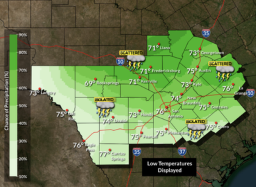
The National Weather Service has extended a flood watch for San Antonio, Austin, and the Hill Country until 9 a.m. Monday morning. Additional rainfall amounts of 1-2 inches are forecast, with isolated totals of 3 inches in some areas.

The Hill Country and the northern I-35 corridor will see the highest chances of isolated showers and thunderstorms on Sunday night and early Monday morning. Low temperatures will range from the upper 60s to the middle 70s

The flood watch is in effect for the following counties: Bandera, Bexar, Blanco, Burnet, Comal, Edwards, Gillespie, Hays, Kendall, Kerr, Kinney, Llano, Medina, Real, Travis, Uvalde, Val Verde and Williamson.
The flood watch advisory is issued when conditions are favorable for possible flooding. The National Weather Service says those living in areas prone to flooding should be prepared to take action should flooding develop.
The recovery operation for those missing in the July 4th floods in Kerr County was halted Sunday due to weather conditions and is expected to continue after the flood watch expires on Monday.
Sunday’s heavy rain event in the Hill Country rattled flood survivors and relief workers. Flash Flood warnings were issued for several areas on Sunday morning, including the already rain-swollen Guadalupe River.
In Kerr County, officials shut down recovery operations on the Guadalupe and advised those working along the river to evacuate.
Other rivers in Central Texas and the Hill Country experienced flooding from the storm, including Lampasas River near Kempner, Llano River near Llano, Devil’s River in Val Verde County, Colorado River near San Saba and the San Saba River at Menard.
