Sign up for TPR Today, Texas Public Radio's newsletter that brings our top stories to your inbox each morning.
Another cold front will blow into San Antonio by Thursday night to continue the chilly end of January for the Alamo City, according to the National Weather Service.
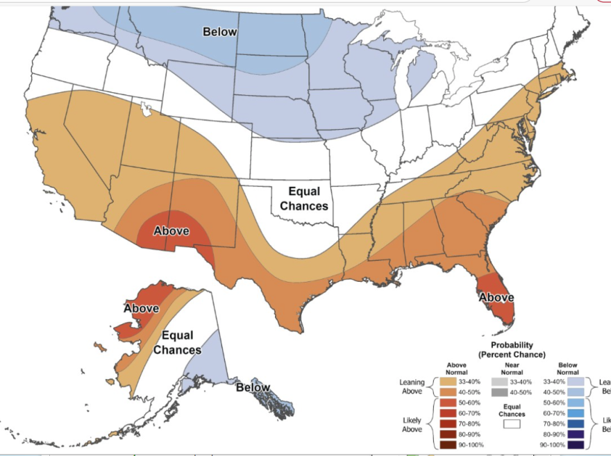
Enjoy the cool while it lasts because the long winter outlook had not changed for San Antonio. The Weather Prediction Center expects warmer than usual weather to continue. San Antonio's average last freeze is around Feb. 24, according to weather records.
The week began with highs in the 30s after an arctic cold front arrived last weekend. Highs are expected to warm to around 60 or a little higher on Thursday and Friday before the front pushes through.
Weekend highs are expected to hover just above or just below 50. A low around 30 is likely Saturday morning and Sunday morning will see a low in the mid 20s.
The next work week begins with highs around 60 or a little higher.
There is a very slight chance of precipitation on Monday night and Tuesday. About an inch of rain has fallen in January at San Antonio International Airport, about half of the amount of precipitation that usually falls.
2026 marks the start of San Antonio's seventh year with drought conditions. Customers of the San Antonio Water System remain under Stage 3 water restrictions and can only water with an automated sprinkler once a week based on street address. Hand watering by garden hose is permitted at any time.
Residents may want to limit new spring planting or look for drought tolerant plants to enhance their landscapes with water restrictions still in place.


