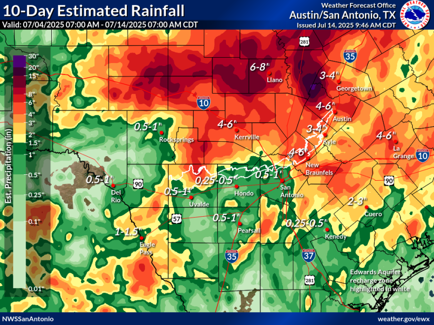
Search and recovery teams in areas that were flooded when the Guadalupe River burst from its banks on July 4 struggled to continue their work on Monday as another wave of strong storms darkened the western and southwestern horizons.
Emergency management officials tried to work around the patchwork of flood watches and warnings — suspending work in some areas and resuming work in others — as one storm after another drenched different parts of Kerr County, sparking harrowing evacuation orders for an exhausted Hill County community.
For example, at 12:28 p.m., Kerr County officials warned: "All search teams in the river corridor need to move to higher ground now. Only teams working under the direction of Kerr County Emergency Operations Center Unified Command are permitted in the response zone."
A flood watch was in effect for the ravaged region until 9 p.m. Monday. That watch does not include Bexar County.
Flood Watch continues for the Hill Country, Edwards Plateau, and Travis/Williamson Counties until 9 PM CDT today. Additional rain of 1 to 2 inches are possible with isolated amounts of 3 to 5 inches possible. Runoff could result in flash flooding and rises in river levels. #txwx pic.twitter.com/w0XJbFqxjb
— NWS Austin/San Antonio (@NWSSanAntonio) July 14, 2025
The National Weather Service (NWS) reported one to two inches of rain was possible to the west and north of the Alamo City, and as much as three to five inches could fall in isolated spots.
Forecasters explained that two mesoscale convection vortexes — one near Waco, and one near the Rio Grande — pulled in storm cells and placed them in circling patterns over the same areas, unleashing more dangerous floodwaters.

