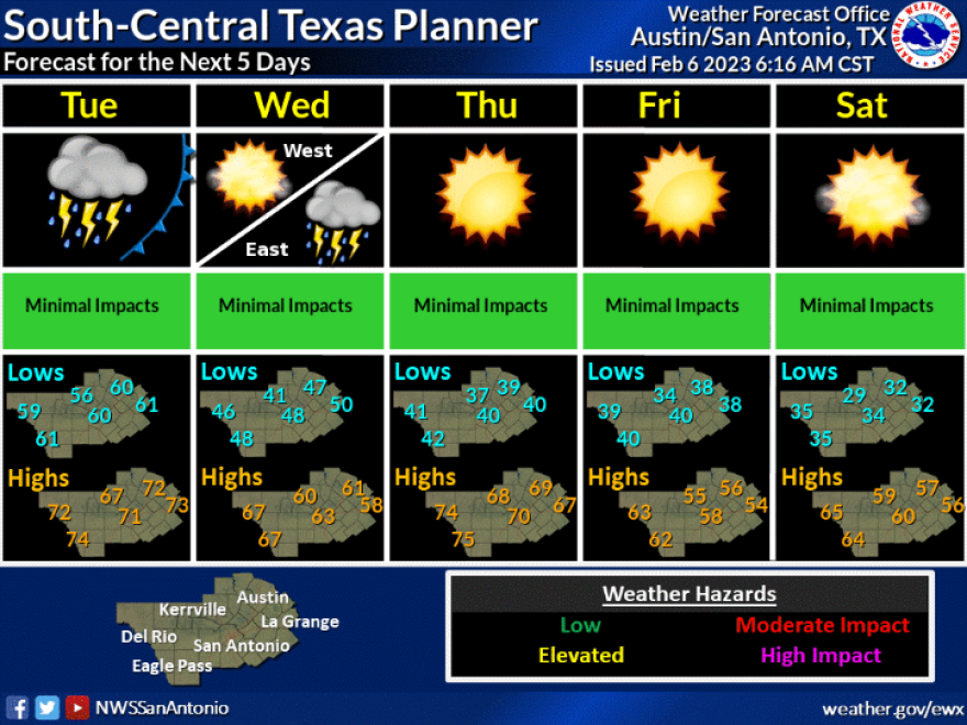
There's a strong chance for showers in San Antonio on Tuesday and Wednesday of this week, according to the National Weather Service.
Forecasters said a cold front will begin to trigger showers by Tuesday afternoon as it pushes into South Texas.
The heaviest of the showers are expected to be east of U.S. 281, where there is a marginal risk of severe thunderstorms.
Around 1.5 inches is possible and further east, outside of the I-35/I-17 corridor, three-to-four inches of rain is possible.
Damaging wind gusts are also likely. San Antonio can expect wind gusts of 25 and 30 miles per hour on Tuesday and Wednesday.
The shower activity is expected to taper off by midday on Wednesday.
The cold front will not impact temperatures too much with highs in the 60s on Wednesday. San Antonio still has some chilly winter days ahead, however, with lows on Saturday and Sunday mornings this weekend in the 30s and highs just above or just below 60.
San Antonio has seen just over an inch-and-a-half of rain at the international airport since Jan. 1. The rainfall deficit for the year is a little more than an inch, but San Antonio ended 2022 with rainfall deficit of around 20 inches.
Residents are still under Stage 2 water restrictions as the busy spring planting season lies just around the corner. Under Stage 2, residents can water their yards with automatic sprinklers just once a week based on street address.
Spring planting should take off after March 1, the date of the city's typical last freeze of the year. But local green thumbs said it's a good idea to wait later than March 14, the date of San Antonio's latest recorded freeze.


